Showing posts with label Hiking. Show all posts

Tuesday, June 05, 2012

Reunion - Hike to Piton de la Fournaise

For our second hike on Reunion, we set ourselves quite an ambitious goal, the 2632m high Piton de la Fournaise.

The day began early, very early in the morning at 6AM in freezing temperatures by driving to the foot of the volcano
From INDIAN OCEAN - Reunion
Note: no, that is NOT the sun but the moon...

We started early as we wanted to being the hike just at sunrise (the colors being amazing at this time):
From INDIAN OCEAN - Reunion


The hike began with a 150m descent first from an outer ridge (in the background) of the secondary crater, leading to a long, that is few-hours long "moonwalking"
From INDIAN OCEAN - Reunion

In order to get a few nice photo shots we climbed some smaller craters:
From INDIAN OCEAN - Reunion


The hike then continued on a mars-like landscape...
From INDIAN OCEAN - Reunion

before reaching the main crater.
From INDIAN OCEAN - Reunion

Note: this photo we did not take during the hike, but two days after from air.


The climb of the main crater was quite a challenge and seemed never-ending as the route went spiraling up, each time giving the impression the summit is "just around the corner" just for a new stretch to unfold.

...forward a couple of hours...
From INDIAN OCEAN - Reunion

...notice the small bump at center left in the background? That is the "small" crater from before...

Going around one of those "corners" offered us an incredible view of the main lava flow
From INDIAN OCEAN - Reunion


and the next corner of the most recent lava flow, both leading down to the ocean (some 2300m below us):
From INDIAN OCEAN - Reunion


Forward a couple of hours more...we finally reached the ridge of the main crater:
From INDIAN OCEAN - Reunion

... a rewarding site it was.

As always, we did not go alone, taking Gulliver with us
From INDIAN OCEAN - Reunion


The descent wasn't particularly easy either, especially walking through the "martian desert" seemed endless, but after the 7-8hours hike, we were both proud to look back to our "achievement":
From INDIAN OCEAN - Reunion
check out all pictures of the hike to Piton de la Fournaise

Sunday, June 03, 2012

Reunion - Hike to Piton d'Anchaing

On our second day on Reunion it was hiking time - big time:

From INDIAN OCEAN - Reunion


We chose the Piton d'Anchaing at 1356m for its picturesque location in the middle of Cirque de Salazie, with the idea that we will have a superb panoramic view once we get on top of it. However, that meant climbing for about 4 hours and about 750m in altitude.

The hike started at our accommodation for the night at Hellbourg, at the foot of the piton
From INDIAN OCEAN - Reunion


The humidity was close to 100%, but we did not mind as this meant the vegetation was incredibly dense and green
From INDIAN OCEAN - Reunion


The climb was not particularly easy, but definitely rewarding:
From INDIAN OCEAN - Reunion


Krisztina did a fantastic job,  she showed no sign of carrying one more person, she was as energetic and smiling as always:
From INDIAN OCEAN - Reunion


Unfortunately upon reaching the peak of the piton, our vision of panoramic views of Salazie started to fade, as clouds gathered
From INDIAN OCEAN - Reunion


Even with the clouds covering the sky at the end it was still a great tour...
...even though we had to leave our motorcycle behind :-)
From INDIAN OCEAN - Reunion


(we are still puzzled why that sign was up there as there were like 100 stairs leading to the hanging bridge).


All our pictures from the hike.


Tuesday, September 14, 2010

Hiking on Mt Rigi: Urmiberg to Rigi-Kaltbad

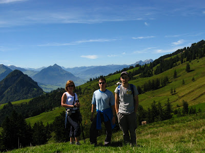
In preparation for our Tibet-Nepal overland tour in less than two weeks we decided to work on our physical condition last weekend and went hiking with our friend M. Zoli. Our choice was one of the classic alpine routes in Mt Rigi, a 5-hour-hiking tour with splendid alpine panorama: 4 lakes seen almost simultaneously deep below surrounded by the Swiss Alps and lots of Milka-cows all around.
From Hiking_Cycling_Fun

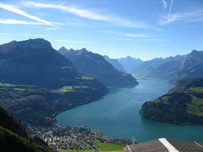
We started our tour in Brunnen on the shore of Lake Luzern by taking a small cable-car up to Urmiberg, then continued our way along the Gätterlipass to Rigi-Scheidegg (1.545m).  High above lake Luzern we had a wonderful panorama all-around:
From Hiking_Cycling_Fun

After a short lunch break at Rigi-Scheidegg we continued our trail to Rigi-Kaltbad, where we took the Rigi-Bahn down to Vitznau. It was time for a well-deserved, real Swiss dinner... too bad our favorite "Roestli- restaurant" at the Tellskapelle changed their business direction and 'Swiss roestli' was not on the menu any more (so we choose to go rather for a Mexican dish next door).

See more photos of this tour here.

Gorges of Switzerland: Taminaschlucht

Taminaschlucht is the gorge of the Tamina river, which we visited with my parents a few weeks ago. From Bad Ragaz, it was a nice 4-km-walk along the river until we reached the most narrow part of the valley, where two, almost parallel walls of rock faced each other less than 10 m apart. There is a path constructed along the gorge leading to the grotto of a small thermal spring (as we learned here, this healing spring known as Bad Pfäfers was already used for medical purposes in the Middle Ages).


More photos on Taminaschlucht you may see here.

Tuesday, August 03, 2010

Hiking to Trift glacier & suspension bridge

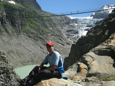
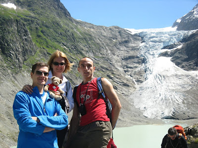
On Saturday we woke up on a sunny morning and headed off for the hiking tour to Trift glacier and suspension bridge in the middle of the Bernese Oberland, which we have been planning for a long time. When we arrived at the station of the little cable car to take us part way up the mountain, we found out that there was a waiting time of 2 hours for the cable car; thus we decided to take the hard way with an extra 4-hour-hiking. It was a slight reward for our efforts that along the trail there were plenty of blueberry bushes, which we of course left 'less blue' behind...

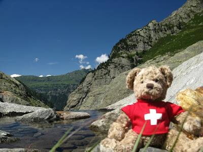
On the occasion of his Big Hiking adventure, Gulliver took his brand new Shirt to celebrate the Swiss National day with (too bad he miscalculated by 1 day):
From Trift

The alpine hike from the top of the cable car up to the bridge took about an hour and half with some stops to admire the gorgeous view of the mountains of the Grimselwelt around.  Finally, we arrived at the recently constructed bridge (in 2009) and its spectacular views. The bridge is 170 meters in length and is suspended over a 100 meter deep canyon, the longest of its type in Europe.
From Trift

The view of the Trift glacier & lake from the bridge appeared calm and wonderful, it was one of the most scenic views we have ever seen in Switzerland.
From Trift

After a short lunch break we headed back, choosing an alternative way, which was indicated as being a 20-minute-'family trail' ... well, it must have been measured with very fit kids, as it took us about double the time and quite an exhausting hike & rock climbing until we reached the Windegg Hut at 1887m. Having some rest here, we continued our way downhill... several 'blueberry stops' along the way, then we finally arrived back to our car at 9:30pm.

It was definitely an amazing, but very exhausting day for all of us. The most tiring Birthday I can remember having :-)) I was even too tired to open my present, so we left the celebration for the following day (blog entry will be posted soon)

Our entire album on this trip may be visited here:
Trift

Wednesday, June 02, 2010

Gorges of Switzerland: Aareschlucht

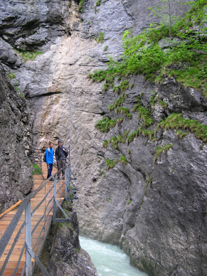
A few weeks ago we were planning a hiking trip in Berner Oberland. Unfortunately the hiking trail we have planned to follow was still closed due to the snow in the mountains, so 'accidentally' we discovered another gorgeous place well worth visiting: Aareschlucht, or 'the Swiss Grand Canyon'.
From Hiking_Cycling_Fun

We have never heard about this place before (but Switzerland is always full of surprizes, especially in the natural wonders category), so we quickly googled up: "the Aar Gorge is a section of the river that carves through a limestone ridge near the town of Meiringen. It is an indirect product of glaciation; 10,000 years ago, just as the Ice Age was coming to an end, torrential runoff from melting glaciers eroded a deep, narrow chasm through the limestone barrier. Although barely 1.6 km long, this passage is bordered by sheer cliffs up to 50 m high on either side. At the bottom of this steep drop the river is scarcely one meter wide.."
Again, we have learned something... and discovered another natural beauty of this country.
You can find here some more photos of Aareschlucht.
.

Wednesday, September 30, 2009

Cinque Terre

Just as the cold and foggy autumn time started to break in to Switzerland, we headed off for a short holiday (or a long weekend ?) to a Cinque Terre, Italy... although not too far from Zurich (about 5 hrs driving), here was still wonderful summer weather, 30+ C and lots of sunshine.

It’s easy to fall in love with Cinque Terre. It’s a line of 5 small towns that are along the eastern coast of Italy. In this area, traveling by car is the most impractical way to get around. The best way to transport yourself is by Train, or Boat, or Foot. We tried all three of them.

First day we started to explore the area by taking a boat trip along the cost, leaving from La Spezia, where our hotel was located. Truly wonderful scenery, and gorgeous villages! Will let the photos speak for themselves, as it is difficult to describe with words.

From EUROPE - ITALY - Cinque Terre & Genoa

For the second day we had big plans. We headed out reasonably early (well, 9:30 is early enough on a holiday, isn't it?) and took the train to Monterosso al Mare, the first city if traveling from the north:
From EUROPE - ITALY - Cinque Terre & Genoa

... and started the Cinque Terre hiking tour:

From EUROPE - ITALY - Cinque Terre & Genoa

............ to Vernazza:

From EUROPE - ITALY - Cinque Terre & Genoa

........ to Corniglia:

From EUROPE - ITALY - Cinque Terre & Genoa

...... to Manarola:

From EUROPE - ITALY - Cinque Terre & Genoa

... and finally, through the Via Dell'Amore, to Riomaggiore....

From EUROPE - ITALY - Cinque Terre & Genoa

We found Cinque Terre one of the most delightful areas we've ever been to and we can fully appreciate why this region has been listed as a World Heritage Site. Almost unbelievable what did native people build in this area. Lots of stones have been used to build the vineyards and the thousands of km-long stone structures to prevent erosion.

The third day we took a less tourist-packed hiking route from Portovenere to Riomaggiore.
In Portovenere we visited the town and castle:
From EUROPE - ITALY - Cinque Terre & Genoa

Then we began our long hike. After being lost once and climbing a few thousand steps, we had magnificent views of the Ligurian coast:
From EUROPE - ITALY - Cinque Terre & Genoa

before descending down to Riomaggiore.

All along our hiking trips we were accompanied by our friend Gulliver who got his own backpack to carry his own stuff.
From EUROPE - ITALY - Cinque Terre & Genoa


Cinque Terre is magical! Make it a destination sometime in your life. We can highly recommend it.
See our entire photo album on Cinque Terre here .

On our last day of our mini-vacation, we visited Genoa as well, where the city is dominated by magnificent historical buildings and the omnipresent scooters:
From EUROPE - ITALY - Cinque Terre & Genoa

Thursday, September 10, 2009

Via ferrata (Klettersteig) in Braunwald

sLast weekend we went rock climbing (Via ferrata) to Braunwald with some friends, namely Gabi, Salo + Ioana and us (unfortunately Gulliver was left out this time, but we are working on some climbing harness for him to be able to join us next time).
The group posing in front of the TARGET


The climb comprised 2 stages:
- An "easy" first stage to "Leiteregg" at 2310m altitude

Salo's @ss on the way to the first peak on the "easy" climb:


which was just a great warm-up for what was about to be

- Stage 2 to the "Vorder Eggstock"at 2449m


me f@rting on the way to the "Vorder Eggstock"...


completing the construction on the peak:


"highway" between two peaks:


finally taking off our helmets for a shot on said further peak "Mittler Eggstock"


after which we had to go down (the worst part, I don't like to go down!!)


all pictures on picasa: http://picasaweb.google.com/gulliver.gyenge/Braunwald#
Posted by Picasa

Saturday, October 20, 2007

Pizol

I was thinking about calling this blog entry "yet another day in paradise" but I decided it would get boring and soon I would end up with too many similarly called entries. This latest trip we made was to Pizol, about one hour's train ride from Zurich. The hike itself, not a very easy one I have to admit, was between 1800 and 2500m above see level and offered a magnificent view of 4 glacier lakes. (Should have been 5 but we missed one by missing a detour). The weather, though quite cold, was gorgeous and the view....

Check out all pictures (sorry about quality but some of the photos were made with cell phone)